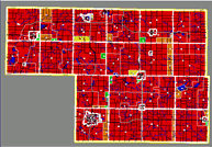
 Typically, a base map theme provides data about a
specific topic, such as population density, using different colors to
represent the data. By adding overlays on top of a map, you can compare
different types of information. For example, if you want to know what
zoning district you live in, select the zoning base map theme, then
overlay parcel lines and locate your property.
Typically, a base map theme provides data about a
specific topic, such as population density, using different colors to
represent the data. By adding overlays on top of a map, you can compare
different types of information. For example, if you want to know what
zoning district you live in, select the zoning base map theme, then
overlay parcel lines and locate your property.
In addition to colors, base map themes and overlays may use lines, shapes, and icons to represent a variety of information. All of this information is defined in the legend.
Most maps have clickable objects which will display additional information either on the map or in a new browser window. The following are usually clickable: points, lines, labels, icons, and shapes such as circles, squares, and diamonds. When clicking on the map, the clickable area closest to the mouse point will display information. This means that no matter where you click, some information will be displayed.
The map scale can be changed using the "Zoom Options" tool. This allows you to see more detail of a specific area.